
Welcome to Flagg Mountain, Alabama’s first mountain!
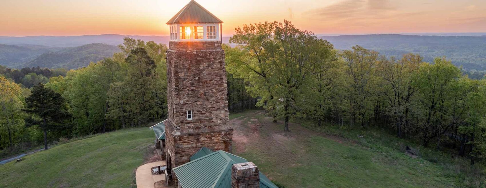
Flagg Mountain marks the beginning of the 170-mile-long Alabama Pinhoti Trail, and provides visitors a glimpse of a unique Alabama ecosystem – montane longleaf pine.
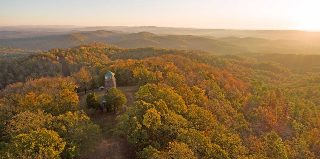
An ADA accessible half-mile path invites all to experience these tough-as-nails mountains while enjoying scenic views of the Coosa and Tallapoosa River valleys as well as the Talladega Mountain range. Over 7 miles of interconnected trails offer hikes for everyone, from seasoned hikers to those looking for an easy stroll.
A native stone and timber tower exhibiting precision craftsmanship gifted by the Civilian Conservation Corps (CCC) in 1935 sits atop the summit. The tower area is open to the public for picnics. Climb the newly renovated stairs to the tower cab for spectacular 360° views of the surrounding mountains.
Cabins and Camping: Stay for the weekend! Five cabins with electricity and fireplaces and constructed by the Civilian Conservation Corps are available for overnight rentals, along with multiple tent and car camping opportunities. Text 256-223-3990 for reservations.


The Journey: Experience east-central Alabama as you make your way to Flagg Mountain. From I-65, cross the Coosa River at Lay Dam and wind through the countryside; or take U.S. 280 through beautiful small towns like Sylacauga and Childersburg.
Things to Do: Sightseeing, hiking seven miles of trails, camping, picnicking, bird watching, basking in nature or just enjoying the view from the top of the tower.
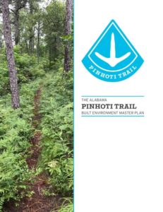
See our guide to the trails of Flagg Mountain below:
Pinhoti Trail 1
Pinhoti Trail 1: Starts in a mixed pine stand along a hillside slowly gaining elevation, climbing along the hillside toward Flagg Mountain. Along the way The Yellow Trail 1 Trailhead from Weogufka Forest Road runs directly parallel with the Pinhoti before the blue blazes track up the mountain to the fire tower.
Pinhoti Trail 2
Pinhoti 2: Mixed-hardwood, rocky and steep climbing portion of the Pinhoti. From the bottoms you climb several 100ft up switchbacks, stepping over rocks and large roots on the way up. Not much vegetation along this portion, almost seems “arid” in feel. Blackjack oaks everywhere. Then you hit the gravel road before making your way up a slick and thin wooden stairway until you finally stumble upon the ADA trail and vista views. Strenuous Hike both up and down.
Pinhoti Trail 3
Pinhoti 3: Starting at the top of Flagg Mountain you traverse down a moderately steep mountain-side, crossing one gravel road on the way down. Several opportunities to stop and sit at benches at the top. Once hitting the middle of the trail, just south of the cabins, you come out on a road that eventually leads you up and around all the cabins. More opportunities to stop and rest at these cabins. Continuing along the CC Camp Road until the trail breaks-off along what looks to be an abandoned roadbed.
Pinhoti Trail 4
Pinhoti Trail 4: This section of the trail resides in mixed hardwood/long leaf pin stands. The trail is along a gradually declining (From west to east) abandoned roadbed along the ridge of the hill. Great opportunity here to see young and old long leaf. Lots of chestnut oaks throughout, scattered beechs and blackjack oaks as well.
White Trail
White Trail: Starting from the western end, you gradually decline into a lovely stream crossing. Here you have plenty of space to take a step off the trail and enjoy the surroundings before moving on up the trail. After traversing the small stream, you begin the climb up the mountain. This is a slow climb and a tiresome little hike (in my opinion) which is why I would keep this as a strenuous level. On the eastern end of the trail you get a great opportunity to see some older longleaf pine stands. There is a bit of blow-down as well in one small section but the trail has been cut through and is open now.
Yellow Trail 1
Trailhead off Weogufka Forest Rd joining teams with the Pinhoti Trail up the mountain until Yellow Trail breaks off on a lovely mixed hardwood Rocky Mountain -side stroll. This part of the trail doesn’t change elevation much until you slowly lower to a bridge that crosses a tricking stream. I will say we need to do a lot of work here. It is SUCH a great spot but tons of massive blow down. One of which you have to pretty much bear crawl under right after going over the bridge. Also, 2 broken wood panels in the bridge causing a pretty good hazard for hikers, esp older ones. After crossing the bridge you continue climbing the adjacent mountain side following the stream up to its source and beyond. The northeaster part of the trail does get a little steep but once you reach the top, you’re greeted with a picnic bench and mailbox to kickback and relax before continuing on.
Yellow Trail 2
This is a short, sweet and strenuous trail. I need to re-hike this to give better description. I just can’t remember all that much.
Yellow Trail 3
Yellow Trail 3: I need to re-hike but here is a go. Lovely curvy bottomland hike before slowly gaining elevation. Trail head off of CC Camp Road allows for parking along the roadway and is equipped with signage and a kiosk for wayfinding and gathering up-to-date forest/trail information. Pink trail can be seen breaking off to the east while Yellow 3 meanders through the bottomland. Blow down in this areas as well (start of the hike). Eastern section of the trail gradually climbs before spitting you out at the top of the mountain where brick chimneys, platforms, picnic tables, and fire rings can be explored before continuing down the mountainside onto Yellow 2.

Check out our Pinhoti Master Plan
Download the Master Plan and see what is in store for the Pinhoti Trail.